PHYSIOGRAPHY OF INDIA
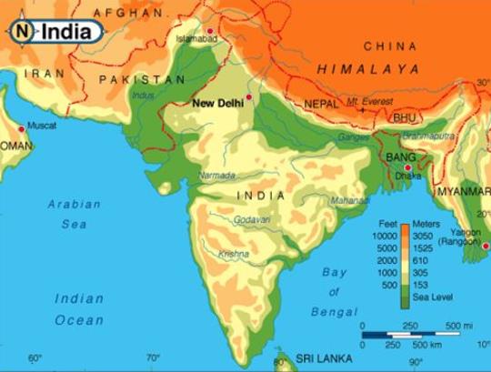 Physiographically, India can be divided into 5 units:
1. Northern Mountains
2. Northern Plains
3. Plateau region of the South
4. Coastal plains
5. Islands
Areas with different altitudes
The northern mountains consist of
1. Himalayan mountains
2. Trans-Himalayas
3. Eastern-Himalayas or Purvanchal
The Himalayas
1. Means ‘Abode of Snow’.
2. They are one of the youngest fold mountain ranges in the world and comprise mainly sedimentary rocks.
3. They stretch from the Indus River in the west to the Brahmaputra River in the east.
4. Total length is about 5000 km.
5. The width of the Himalayas varies from 500 km in Kashmir to 200 km in Arunachal Pradesh.
6. Their average height is 2000 m.
7. The Pamir, popularly known as the Roof of the World, is the connecting link between the Himalayas and the high ranges of Central Asia.
Himalayas can be divided into 3 parallel or latitudinal ranges:
1. Great Himalayas or Himadari
2. Lesser Himalayas or Himachal
3. Outer Himalayas or Shivalik
Greater/ Outer Himalayas/ Himadari
(i) The average height is 6000 m.
(ii) The average width is 120 to 190 kms.
(iii) These ranges are composed of archean rocks like granite, gneisses, and schists.
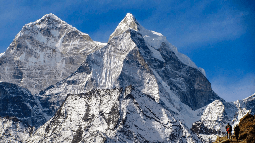 Mt. Annapurna
(iv) There are few passes and almost all of them have a height above 4,500 m.
(v) They include
a. Shipki La and Bara Lapcha La in Himachal Pradesh,
b. Burzil and Zozi La in Kashmir,
c. Niti, Lipulekh and Thag La in Uttarankhand,
d. Jelep La and Nathu La in Sikkim.
Lesser Himalayas/Himachal
(i) These ranges have an average height of 3500-5000m and have a width of 50-80 km.
(ii) These ranges are composed of metamorphic rocks.
(iii) This range has the famous and beautiful hill stations which include Shimla, Mussoorie, Nainital, Ranikhet etc.
 Lesser Himalayas(iv) Important ranges include Pir Panjal, Dhaula Dar, and Nag Tiba.
(v) In Uttarakhand, the Middle Himalayas are marked by the Mussoorie and the Nag Tibba ranges.
Sub Himalayas or Shivaliks
(i) These ranges have an average height of 1000 to 1500 m. and have an average width of 15 to 50 kms.
(ii) These ranges are made of clay, sand, gravel, slate, boulders etc.
(iii) The Doon valleys are situated in the ranges which include Dehradoon, Patlidoon, and Kothridoon.
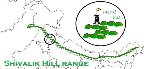 Shivalik rangeLongitudinally Himalayas can be divided into the following 4 sections.
1. Punjab Himalayas; between Indus & Satluj
2. Kumaon Himalayas; between Sutlej & Kali
3. Nepal Himalayas; between kali & Tista
4. Assam Himalayas; between Tista & Dihang
TRANS – HIMALAYAS
1. This range lies to the north of the Great Himalayas.
2. It has some important ranges like Karakoram, Laddakh, Zanskar, etc.
3. the highest peak in this region is K2 or Godwin Austin (8611m, in Pak occupied Kashmir).
4. Other high peaks are Hidden Peak (8068 m), Broad Peak (8047 m) and Gasherbrum II (8035 m).
5. The longest glacier is Siachin in the Nubra valley, which is more than 72 km long (biggest glacier in the world).
6. Biafo, Baltaro, Batura, Hispar are the other important glaciers in this region.
7. This area is the largest snow-field outside the Polar Regions.
8. The Eastern Himalayas-made up of Patkai Hills, Naga Hills, Mizo Hills and the Garo, Khasi and Jaintia Hills-are also known as Purvanchal.
NORTH INDIAN PLAINS
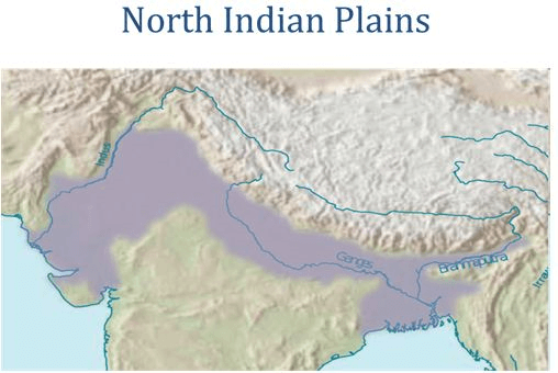 North Indian plains(i) Formed by the alluvial deposits brought down by the rivers- Indus, Ganga & Brahmaputra.
(ii) The westernmost portion is occupied by the Thar Desert.
(iii) Approx. 3200 km long & 150-300 km wide.
(iv) Can be divided into following zones:
a. Bhabar
b. Terai
c. Bangar
d. khadar
e. Bhabar Belt
Comments
Post a Comment